
Page 196 - UAE National Geospatial Feature Catalogue
P. 196
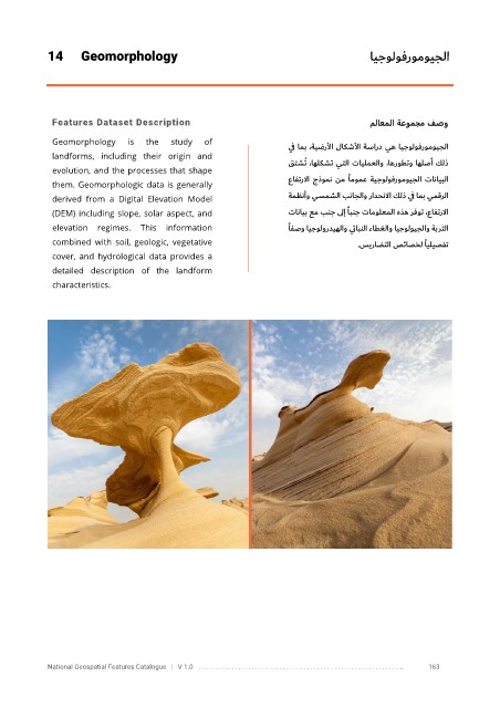
14      Geomorphology                                                             ايجولوفرومويجلا


             Features Dataset Description                                                  ملاعملا  ةعومجم فصو

             Geomorphology     is   the   study   of                   ي ف امب ،ةيضرلأا لاكشلأا ةسارد يه ايجولوفرومويجلا
             landforms,  including  their  origin  and
                                                                       قتشُت   ا   ، هلكشت يتلا تايلمعلاو   ،اهروطتو اهلصأ كلذ
             evolution, and the processes that shape
             them. Geomorphologic data is generally                    عافترلاا جذومن نم      ًامومع ةيجولوفرومويجلا تانايبلا

             derived  from  a  Digital  Elevation  Model               ةمظنأو يسمشلا بناجلاو رادحنلاا كلذ ي ف امب يمقرلا
             (DEM) including slope, solar aspect, and                 تانايب عم بنج ىلإ  ًابنج تامولعملا هذه رفوت    ،   عافترلاا
             elevation  regimes.  This  information                    ًافصو ايجولورديهلاو ي تابنلا ءاطغلاو ايجولويجلاو ةبرتلا
             combined  with  soil,  geologic,  vegetative                              سيرا ضتلا صئاصخل  ًايليصفت
                                                                                      .
             cover,  and  hydrological  data  provides  a

             detailed  description  of  the  landform

             characteristics.


            National Geospatial Features Catalogue   |   V 1.0   . . . . . . . . .. . . . . . . . . . . . . . . . . . . . . . . . . . . . . . . . . . . . . . . . . . . . . . . . . . ..               163