
Page 317 - UAE National Geospatial Feature Catalogue
P. 317
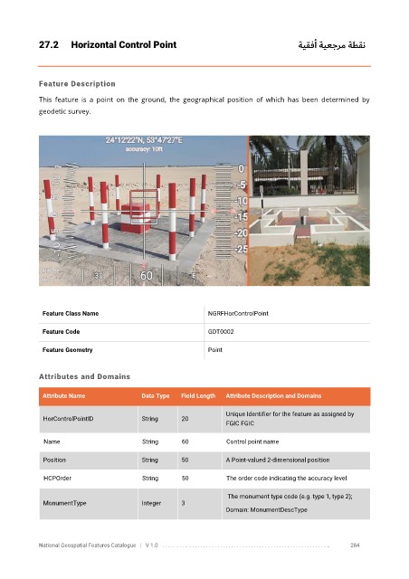
27.2      Horizontal Control Point                                           ةيقفأ ةيعجرم ةطقن


            Feature Description

            This  feature  is  a  point  on  the  ground,  the  geographical  position  of  which  has  been  determined  by
            geodetic survey.


             Feature Class Name                               NGRFHorControlPoint


             Feature Code                                     GDT0002

             Feature Geometry                                 Point


            Attributes and Domains

             Attribute Name               Data Type   Field Length   Attribute Description and Domains


                                                                   Unique Identifier for the feature as assigned by
              HorControlPointID           String      20
                                                                   FGIC FGIC

              Name                        String      60           Control point name

              Position                    String      50           A Point-valued 2-dimensional position

              HCPOrder                    String      50           The order code indicating the accuracy level


                                                                    The monument type code (e.g. type 1, type 2);
              MonumentType                Integer     3
                                                                   Domain: MonumentDescType


            National Geospatial Features Catalogue   |   V 1.0   . . . . . . . . .. . . . . . . . . . . . . . . . . . . . . . . . . . . . . . . . . . . . . . . . . . . . . . . . . . ..               284