
Page 570 - UAE National Geospatial Feature Catalogue
P. 570
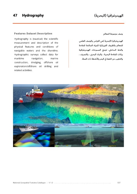
47      Hydrography                                                      )ةيرحبلا(  ايفارغوديهلا


             Features Dataset Description                                                    ملاعملا    ةعومجم فصو

             Hydrography  is  (nautical)  the  scientific
             measurement  and  description  of  the                    يملعلا فصولاو سايقلا يه (  ةيرحبلا )   ايفارغورديهلا
                                                                       ةحلاملل  ةحلاصلا  هايملل  ةيئايزيفلا  فورظلاو  ملاعملل
             physical  features  and  conditions  of
             navigable  waters  and  the  shoreline.                   ةيفارغورديهلا    تاحوسملا  عمجت  ،    يلحاسلا  طخلاو

             Hydrographic  surveys  collect  data  for                 ، فيرجتلاو ، يرحبلا ءانبلاو ، ةيرحبلا ةحلاملل تانايب
             maritime       navigation,      marine                      .    ةلصلا تاذ ةطشنلأاو رحبلا ي ف طفنلا نع بيقنتلاو
             construction,  dredging,  offshore  oil

             exploration/offshore  oil  drilling  and
             related activities.


            National Geospatial Features Catalogue   |   V 1.0   . . . . . . . . .. . . . . . . . . . . . . . . . . . . . . . . . . . . . . . . . . . . . . . . . . . . . . . . . . . ..               537