
Page 614 - UAE National Geospatial Feature Catalogue
P. 614
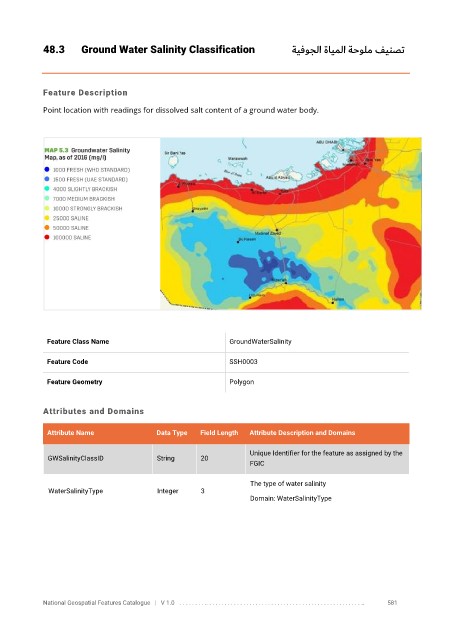
48.3       Ground Water Salinity Classification                    ةيفوجلا ةايملا ةحولم فينصت


            Feature Description

            Point location with readings for dissolved salt content of a ground water body.


             Feature Class Name                              GroundWaterSalinity

             Feature Code                                    SSH0003

             Feature Geometry                                Polygon


            Attributes and Domains

             Attribute Name               Data Type   Field Length   Attribute Description and Domains


                                                                   Unique Identifier for the feature as assigned by the
              GWSalinityClassID           String      20
                                                                   FGIC

                                                                   The type of water salinity
              WaterSalinityType           Integer     3
                                                                   Domain: WaterSalinityType


            National Geospatial Features Catalogue   |   V 1.0   . . . . . . . . .. . . . . . . . . . . . . . . . . . . . . . . . . . . . . . . . . . . . . . . . . . . . . . . . . . ..               581