
Page 142 - UAE National Geospatial Feature Catalogue
P. 142
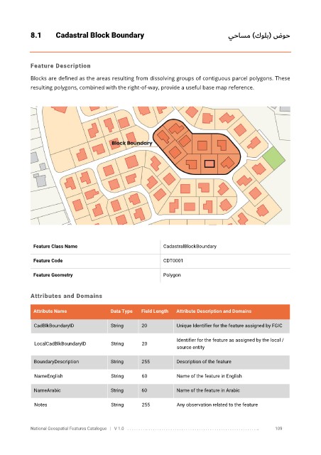
8.1       Cadastral Block Boundary                                          يحاسم )كولب( ضوح


            Feature Description

            Blocks are defined as the areas resulting from dissolving groups of contiguous parcel polygons. These
            resulting polygons, combined with the right-of-way, provide a useful base map reference.


             Feature Class Name                               CadastralBlockBoundary


             Feature Code                                     CDT0001

             Feature Geometry                                 Polygon


            Attributes and Domains

             Attribute Name               Data Type   Field Length   Attribute Description and Domains


              CadBlkBoundaryID            String      20           Unique Identifier for the feature assigned by FGIC

                                                                   Identifier for the feature as assigned by the local /
              LocalCadBlkBoundaryID       String      20
                                                                   source entity

              BoundaryDescription         String      255          Description of the feature

              NameEnglish                 String      60           Name of the feature in English


              NameArabic                  String      60           Name of the feature in Arabic

              Notes                       String      255          Any observation related to the feature


            National Geospatial Features Catalogue   |   V 1.0   . . . . . . . . .. . . . . . . . . . . . . . . . . . . . . . . . . . . . . . . . . . . . . . . . . . . . . . . . . . ..               109