
Page 157 - UAE National Geospatial Feature Catalogue
P. 157
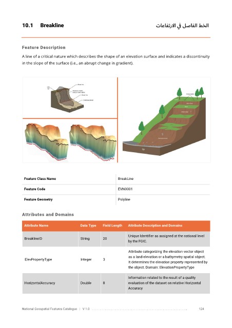
10.1      Breakline                                                               تاعافترلاا  ي ف لصافلا طخلا


            Feature Description

            A line of a critical nature which describes the shape of an elevation surface and indicates a discontinuity
            in the slope of the surface (i.e., an abrupt change in gradient).


             Feature Class Name                               BreakLine

             Feature Code                                     EVN0001

             Feature Geometry                                 Polyline


            Attributes and Domains


             Attribute Name               Data Type   Field Length   Attribute Description and Domains

                                                                   Unique Identifier as assigned at the national level
              BreaklineID                 String      20
                                                                   by the FGIC.

                                                                   Attribute categorizing the elevation vector object
                                                                   as a land-elevation or a bathymetry spatial object.
              ElevPropertyType            Integer     3
                                                                   It determines the elevation property represented by
                                                                   the object. Domain: ElevationPropertyType

                                                                   Information related to the result of a quality
              HorizontalAccuracy          Double      8            evaluation of the dataset on relative Horizontal
                                                                   Accuracy


            National Geospatial Features Catalogue   |   V 1.0   . . . . . . . . .. . . . . . . . . . . . . . . . . . . . . . . . . . . . . . . . . . . . . . . . . . . . . . . . . . ..               124