Page 160 - UAE National Geospatial Feature Catalogue
P. 160

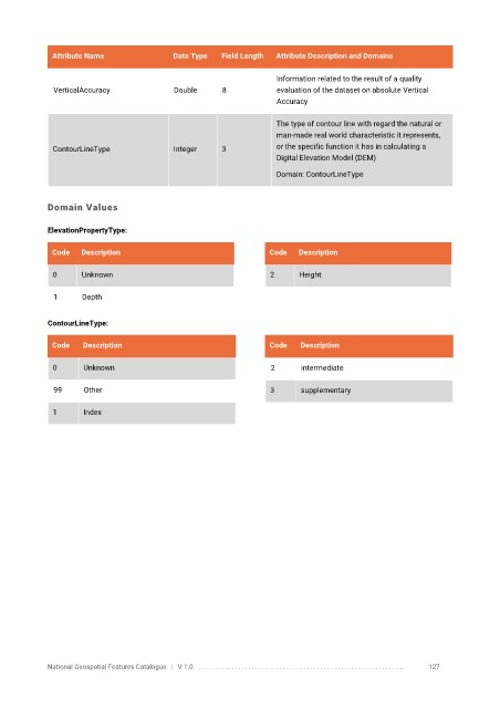
Attribute Name               Data Type   Field Length   Attribute Description and Domains

                                                                   Information related to the result of a quality
              VerticalAccuracy            Double      8            evaluation of the dataset on absolute Vertical
                                                                   Accuracy


                                                                   The type of contour line with regard the natural or
                                                                   man-made real world characteristic it represents,

              ContourLineType             Integer     3            or the specific function it has in calculating a
                                                                   Digital Elevation Model (DEM)
                                                                   Domain: ContourLineType


            Domain Values


            ElevationPropertyType:

             Code   Description                                  Code   Description

              0     Unknown                                      2      Height


              1      Depth

            ContourLineType:


             Code    Description                                 Code    Description

              0      Unknown                                      2      intermediate

              99     Other                                       3       supplementary


              1      Index


            National Geospatial Features Catalogue   |   V 1.0   . . . . . . . . .. . . . . . . . . . . . . . . . . . . . . . . . . . . . . . . . . . . . . . . . . . . . . . . . . . ..               127
   155   156   157   158   159   160   161   162   163   164   165