
Page 159 - UAE National Geospatial Feature Catalogue
P. 159
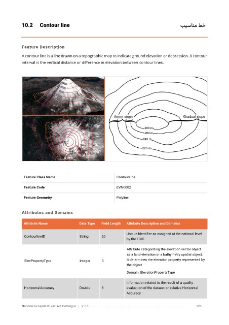
10.2      Contour line                                                                             بيسانم طخ


            Feature Description

            A contour line is a line drawn on a topographic map to indicate ground elevation or depression. A contour
            interval is the vertical distance or difference in elevation between contour lines.


             Feature Class Name                               ContourLine

             Feature Code                                     EVN0002

             Feature Geometry                                 Polyline


            Attributes and Domains


             Attribute Name               Data Type   Field Length   Attribute Description and Domains

                                                                   Unique Identifier as assigned at the national level
              ContourlineID               String      20
                                                                   by the FGIC.

                                                                   Attribute categorizing the elevation vector object
                                                                   as a land-elevation or a bathymetry spatial object.
              ElevPropertyType            Integer     3            It determines the elevation property represented by
                                                                   the object

                                                                   Domain: ElevationPropertyType

                                                                   Information related to the result of a quality
              HorizontalAccuracy          Double      8            evaluation of the dataset on relative Horizontal
                                                                   Accuracy


            National Geospatial Features Catalogue   |   V 1.0   . . . . . . . . .. . . . . . . . . . . . . . . . . . . . . . . . . . . . . . . . . . . . . . . . . . . . . . . . . . ..               126